Introduction:
Modern agricultural operations increasingly use vegetation indices such as biomass indices and the Leaf Area Index (LAI) to monitor the condition of their crops and make informed decisions. These metrics make it possible to objectively quantify plant growth, stand density, and vitality. The following sections define these indices and explain how they are collected, interpreted, and practically applied—both for highly technological precision farming operations and for farmers without digital high-tech equipment. In doing so, the relevance of biomass and LAI data for modern agriculture is highlighted, and the concrete advantages that result in practice are presented.
1. Definition and Explanation of Biomass Index and Leaf Area Index (LAI)
Biomass Index:
The biomass index is a vegetation index that provides insights into the existing plant biomass and the condition of the crop stand. A commonly used biomass index is the NDVI (Normalized Difference Vegetation Index). It is calculated from reflectance measurements in the red and near-infrared (NIR) spectrum and serves as a measure of the “greenness” or density of vegetation (earthobservatory.nasa.gov). Healthy, dense stands absorb a lot of visible light (red) and strongly reflect near-infrared light—the more leaf mass present, the higher the NIR reflectance (earthobservatory.nasa.gov). The ratio of this reflected radiation is converted into an index; for NDVI, the resulting value lies between -1 and +1, with values near +1 indicating high leaf density (earthobservatory.nasa.gov). In general, biomass indices use combined reflectance measurements (typically red and NIR) to make the condition and vitality of plants measurable (dlg.org). Such vegetation indices closely correlate with plant parameters—in scientific studies, NDVI values have been shown to be related to above-ground biomass, LAI, water content, and chlorophyll content of stands (literatur.thuenen.de). Sensors measure the light reflected by the plant canopy and convert the signals into indicator values, allowing indirect estimation of characteristics such as biomass and nitrogen supply status of the crop (dlg.org).
Leaf Area Index (LAI):
The LAI is a dimensionless metric for the foliage density of a plant canopy. By definition, the LAI corresponds to the total leaf area of all leaves per ground area (typically given as one-sided leaf area in m² per m² of ground) (lpvs.gsfc.nasa.gov). In other words: an LAI of 3 means that the leaves of a crop cover the ground with three times the area of the underlying surface. In practice, the LAI is a measure of the green leaf mass and thus the photosynthetically active surface of a crop. It reflects how efficiently a plant canopy can absorb light, which is linked to growth and biomass production (agrarraum.info). A higher LAI indicates a denser, more vigorous crop, while a lower LAI suggests sparse vegetation. LAI is regarded by scientists and authorities as an important indicator—it is considered, among other things, an Essential Climate Variable in climate models and a key metric for assessing ecosystems and agricultural structures (agrarraum.info). Modern remote sensing methods make it possible to derive LAI over large areas from satellite data by converting spectral reflectance values into corresponding LAI estimates (sdi.eea.europa.eu). Overall, both biomass indices (such as NDVI) and LAI provide a quantifiable description of plant stands that can serve as a basis for further analyses and decisions.
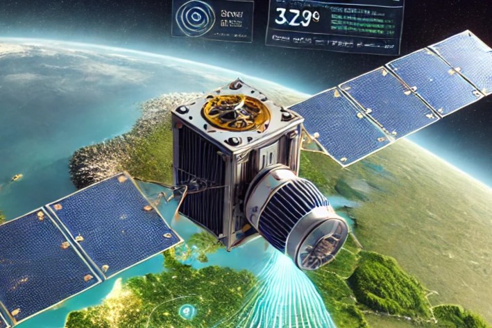
2. Methods for Capturing These Indices (Satellites, Drones, Sensor Systems)
The recording of biomass and LAI indices today is predominantly carried out using remote sensing technologies. Depending on the specific application, satellite imagery, drone footage, or sensors mounted on agricultural machinery are used. What they all have in common is that they provide contactless information about the crop stand.
-
Satellite-Based Remote Sensing:
Satellites (such as the ESA's Sentinel-2 satellites from the Copernicus program or NASA/USGS's Landsat) provide multispectral images of the Earth’s surface from which vegetation indices can be calculated. The advantage of this method lies in its large-scale and regular coverage: freely available satellite data allows for near-daily monitoring of crop conditions (gdi.bmel.de). For example, Sentinel-2 can provide imagery every five days at a 10 m resolution, from which both NDVI maps and LAI estimates can be derived. “Satellite images and aerial photos via airplane or drone provide a precise and up-to-date representation of the Earth’s surface,” the BMEL describes the benefit—by combining various Earth observation systems, a timely and detailed picture of the crop stand is achieved (gdi.bmel.de). One example is harvest forecasting: satellite data is already being used to derive yield expectations and assess the global food supply situation (gdi.bmel.de). For agricultural operations, satellite maps provide valuable information about biomass distribution and developmental differences within fields. Thanks to the free availability of Copernicus data, farmers can access such information “promptly, online, and free of charge” (gdi.bmel.de) (see Section 7). -
Drones (UAV = Unmanned Aerial Vehicles):
Drones equipped with multispectral cameras enable recordings at very high resolution (accurate to the centimeter) at flexible times. They are suitable for obtaining detailed information for smaller areas or specific issues—for example, to detect damaged areas or to create orthophoto-based crop maps. Drones can fly below cloud cover and be deployed precisely when needed by the farmer (e.g., shortly before harvest or fertilization). The data quality is very high because the sensors operate close to the plants. However, the effort involved is greater (flight planning, drone license, etc.), which is why drones are primarily used as a supplement or in individual farm initiatives. In combination with satellite images, they can serve for validation or for capturing details that satellites cannot resolve (e.g., weeds between rows). The BMEL’s remote sensing program describes, for instance, that satellite and drone images can be used together to evaluate the success of measures and to monitor the spread of diseases in the field (gdi.bmel.de). -
Sensors on Agricultural Machinery:
Another method involves in-field sensor systems that take measurements during a pass through the crop stand. In this case, optical sensors (e.g., N-sensors such as Yara N-Sensor, Claas Crop Sensor, John Deere, etc.) are mounted on the tractor or the implement. Depending on the system, they either actively illuminate the stand with their own light source or use sunlight (passive sensors) and measure the reflectance of the plants in specific wavelength ranges (dlg.org). During the pass, they continuously record vegetation indices (often NDVI or related indices) and can control application technology in real time. For example, the nitrogen fertilizer spreader is regulated “on-the-go” to apply more or less fertilizer depending on the measured crop status (gdi.bmel.de). The DLG describes how sensor system data transmission occurs wirelessly or via ISOBUS directly to the tractor terminal, where the values are converted into control commands for fertilizer quantity (dlg.org). Modern systems even allow the integration of additional map layers (e.g., soil maps, yield maps from previous years) to further refine fertilizer optimization (keyword: “map overlay”) (dlg.org). In this way, biomass indices and historical farm data are combined to enable site-specific management. In addition to fertilizer sensors, there are also plant-specific sensors for crop protection (camera systems for weed detection) and soil or yield sensors—all of which provide information that, in combination with biomass and LAI data, create a comprehensive picture of the field.
In summary, farmers today have access to several methods of data collection: satellite images offer wide-ranging and regular data, drones provide flexible and high-resolution detail images, and machine sensors enable immediate data use during fieldwork. In many cases, these technologies are used in combination to leverage the strengths of each layer.
3. Interpretation of the Indices and Economic Conclusions
The biomass and LAI data obtained must be correctly interpreted in order to derive practical decisions from them. In general, high vegetation index or LAI values reflect a lush, vital crop stand, while low values indicate gaps, growth problems, or reduced stand density. This information can be used economically by identifying management zones and optimizing interventions.
-
Identifying Variability in the Field:
A first step in interpretation is to differentiate areas within a field based on varying index values. Biomass maps (e.g., NDVI maps) show spatially where growth is stronger or weaker (dlg.org). Overlaying such maps with other information—such as soil maps or yield maps from previous years—can help determine the causes of differences (dlg.org). For instance, zones with low biomass might correspond to sandy soils (lower water retention) or nutrient deficiency, while high biomass might indicate good soil fertility or over-fertilization. According to the DLG, such “map overlays” can be used to identify areas with higher drought risk or better nutrient availability (dlg.org). For the farm manager, this means identifying heterogeneous yield zones and managing them differentially instead of treating all parts of the field uniformly. -
Assessing the Condition of the Crop Stand:
NDVI and LAI provide insights into the condition of the crop. A high NDVI during the vegetation phase indicates a dense stand well-supplied with chlorophyll—usually a sign of sufficient nitrogen availability and high yield potential. However, excessive biomass can also indicate over-fertilization, which carries the risk of crop lodging. On the other hand, a low NDVI can mean: sparse crop stand, possible nutrient or water deficiency, pest/disease infestation, or delayed development. LAI values allow for similar conclusions—for example, an LAI of 1.0 for cereals early in the year is normal, while an LAI of 5.0 just before flowering indicates a very dense stand. From an economic standpoint, it’s important to distinguish between yield-forming biomass (leaves, stems, ears) and unwanted growth (weeds, biomass not converted into grain). Skilled interpretation of the indices helps determine whether intervention is needed: Should fertilization be applied? Could there be a problem (e.g., waterlogging in one area, visible through delayed vegetation)? Or is the stand so dense that growth regulators might be appropriate? -
Quantitative Estimates:
Indices also allow for quantitative assessments. From NDVI/LAI values at specific growth stages, rough yield forecasts can be derived. For example, as the growing season progresses, it’s often possible to estimate whether a field will yield significantly above or below average (many service providers offer such forecasting models). Likewise, LAI can be incorporated into simulation models to calculate biomass accumulation or water consumption of a crop, which is economically relevant for planning irrigation or harvest timing. A high leaf area means more transpiration—in dry regions, a very high LAI could therefore also indicate impending drought stress, prompting irrigation decisions. -
Risk Assessment:
The spatial distribution of biomass and LAI values can help identify economic risks. For instance, areas with chronically low index values despite full inputs (fertilizer, seed) may indicate low-yield potential. A farmer might conclude that these areas should be managed less intensively in the future or considered for alternative use to minimize losses. Conversely, very high biomass indices show yield potential, but also the risk of lodging or disease pressure—in high-yield areas, more intensive management (targeted fertilization/crop protection) may be worthwhile, as this is where the greatest return can be achieved. Ultimately, these metrics support more precise resource management: inputs (fertilizer, seed, water) can be distributed more effectively, saving costs and stabilizing yields. One study summarizes: “Vegetation indices ultimately serve as a tool for the quantitative determination of plant vitality and are more sensitive to detecting biomass than individual spectral bands alone.” — in other words, they are a reliable indicator for making vitality- and yield-relevant differences visible and economically actionable.
From an economic perspective, farmers derive concrete measures from interpreting these indices (see Section 6). However, it is important to always consider indices in context (weather conditions, growth stage, crop type) and—especially in the case of anomalies—conduct field inspections and possibly sampling to verify the cause.
4. Applications in Precision Farming – Advantages for Digitally Equipped Operations
Farms equipped with modern digital technology (Precision Farming) can fully automate the integration of biomass and LAI data into their operational workflows and derive significant benefits from it. By linking data acquisition, data processing, and machinery, the indices are directly translated into action in the field, optimizing work processes and conserving resources.
-
Automated Fertilization and Application:
One of the greatest advantages is seen in site-specific fertilization. Precision farming operations often use GPS-guided fertilizer spreaders or crop protection sprayers with variable rate control. Here, biomass maps or real-time sensor data can serve directly as application maps. Optical N-sensors, for example, measure the condition of the plants (biomass, chlorophyll) during the pass and regulate nitrogen fertilizer application in real time for each sub-area (gdi.bmel.de). This leads to a more needs-based distribution of fertilizer: lush areas receive slightly less, weaker areas slightly more—with the goal of achieving a uniform yield level. The DLG reports that such systems are connected to the tractor terminal via ISOBUS or Bluetooth and can, in addition to live measurements, also take past yield or biomass maps into account using the “map overlay” method (dlg.org). This continuously refines crop management. In practice, it has been shown that nitrogen fertilizer savings are possible without risking yield losses, by distributing fertilizer more efficiently (dlg.org). This not only improves profitability (fertilizer is expensive) but also reduces environmental impacts from nitrogen surpluses. -
Crop Protection and Growth Regulators:
Digitally equipped operations can use remote sensing data to apply crop protection products in a targeted manner. For example, by analyzing satellite and drone data, disease or pest hotspots in the field can be identified (gdi.bmel.de). With GPS-controlled sprayers, only the affected sub-areas can then be treated instead of spraying the entire field. The same applies to weed management: Precision farming setups use cameras to detect weeds or rely on high-resolution NDVI maps to locate weed patches. With section control, herbicide nozzles can then be activated only where necessary. The BMEL confirms that high-resolution optical satellite images (≤10 m) are increasingly being used to locate weed occurrences in order to limit control measures to those specific areas (gdi.bmel.de). For the operation, this means saving crop protection products and reducing stress on unaffected crops—an economic and ecological gain. Applications of growth regulators in cereals can also be optimized using biomass maps: dense stands (high LAI) can be specifically treated to prevent lodging, while the product is spared in weaker areas. -
Yield Mapping and Learning Systems:
Precision farming operations often collect yield data at harvest using yield mapping systems on the combine harvester. When combined with NDVI/LAI data collected throughout the season, digital farm management systems can learn correlations. Over the years, a clearer picture emerges of which biomass patterns lead to which yields. Such a system might recognize, for instance, “that a certain combination of conditions results in a certain yield,” which makes predictions more accurate every year and allows decisions to be further automated (dlg.org). In the future, AI-powered decision support tools could provide real-time recommendations to farmers based on biomass and LAI trends in combination with weather data (e.g., “Lodging is likely on sub-area X due to very high biomass and upcoming rainfall—apply growth regulator”). -
Integration into Farm Management:
Many digital operations use farm management software that offers integrated remote sensing data. For example, LAI or biomass maps derived from satellite data can be automatically loaded into the farm software. Farms with their own weather stations and soil sensors link these data sources as well. A smart farming approach connects all of this information. The goal is fully integrated decision-making, where the farmer is optimally supported. The concept of “Smart Farming” expands Precision Farming in exactly this way—namely, by “linking and automatically processing information not in isolation, but in context” (dlg.org). Biomass and LAI information play a key role in this, as they quantify the current crop status. As a result, digitally equipped farms manage their fields more efficiently, more sustainably, and often with increased yields: investments are made exactly where they are worthwhile, and savings are made where they are not needed.
In summary, Precision Farming technologies, in combination with biomass/LAI data, enable a new quality of farm management. Decisions are data-driven and often automated, which saves labor time and increases the precision of operational measures. Larger farms with the appropriate technology especially benefit from these advantages, as they are capable of analyzing and directly implementing the abundance of data (gdi.bmel.de). The investment in digital equipment pays off through more efficient production and higher yields or savings in operational resources.
5. Benefits for Farmers Without Precision Farming Technology
Even without high-tech equipment, farmers can practically benefit from biomass and LAI data. Not every farm has real-time sensors or automated fertilizer spreaders—but thanks to freely available remote sensing data and easily accessible services, the entry barrier into data-driven farming is low. Here are some of the practical advantages for traditionally operating farms:
-
Using Free Satellite Information:
As described in Section 7, programs like Copernicus/ESA provide a wide range of freely accessible data. There are online platforms and smartphone apps where farmers can view up-to-date NDVI maps of their fields with minimal effort. These services already process the complex remote sensing data in a user-friendly way. “End users without advanced remote sensing knowledge receive information on crop parameters (e.g., biomass, LAI) automatically and almost in real time from various providers.” (gdi.bmel.de) This means such information is available to every farmer, without needing to analyze satellite images themselves. A conventional farm can, for example, take a look at the NDVI map once a week: Where is the field evenly green? Where are the “problem areas”? This kind of monitoring is virtually cost-free and only requires internet access. -
More Targeted Field Observation (“Scouting”):
Even without digital machines, a farmer can use the indices to inspect fields more efficiently. In the past, one might walk systematically across the field to spot differences. Today, biomass maps can help focus field inspections. If the map shows a significantly lower NDVI at the northwest edge of the field, that’s exactly where you’d go to check for issues—perhaps there’s pest damage, waterlogging, or even a failure in seed germination. This saves time and allows for earlier detection of problems. -
Manual Site-Specific Management:
Even without automatic spreaders, a farmer can fertilize different areas differently. For example, biomass zones can be marked manually (using GPS apps or flags in the field) and treated differently during fertilization. A practical farmer might use the NDVI map to decide: “I’ll apply a bit more fertilizer to the back part of the field, and less on the slope in the front.” While adjustments are done manually (e.g., changing spreader settings or briefly shutting it off), the principle of Precision Farming is being imitated on a small scale. This allows farmers to save fertilizer or stabilize yields without investing in expensive equipment. The same applies to seeding: by recognizing that certain areas of a field are weaker, seeding density can be adjusted accordingly using basic tractor-level controls. -
Leveraging Advice and Community Support:
Many farmers without their own digital infrastructure benefit from advisory services that utilize these indices. Agricultural advisory groups, cooperatives, or official advisory services use remote sensing data to issue guidance and alerts. For example, advisors may say: “Based on satellite data, there are signs of drought stress in your fields—check soil moisture.” Or regional yield estimates may be published, helping with harvest planning. This kind of information allows even smaller-scale farms to make better decisions. -
No Fear of Technology:
Another advantage for low-tech farms is that dealing with the data is now very user-friendly. There's no need for a dedicated GIS specialist. Often, apps or web portals are enough, which display the farmer’s fields (sometimes automatically based on subsidy application data) and continuously provide NDVI values. As such, all farms—even without high-end equipment—can participate in the digital evolution. The BMEL emphasizes that such data is practically usable by anyone without expert knowledge, since service providers prepare it in an easily understandable way (gdi.bmel.de). This broader access ensures that the benefits of biomass and LAI data are not reserved exclusively for large, high-tech farms.
In short: Farmers without their own Precision Farming devices can use biomass and LAI information as an additional decision-making tool. They improve their field observation skills, can time and adjust measures more accurately, and indirectly benefit from digital insights—all at low cost. This allows them to take first steps toward “Smart Farming,” which often already brings noticeable operational improvements.
6. Application Possibilities in Agriculture (Fertilizer Optimization, Yield Forecasts, Crop Management)
Biomass and LAI data are used in many areas of agricultural practice. Some key fields of application—with their associated benefits—include:
-
Optimizing Nitrogen Fertilization:
Historically, a primary focus of remote sensing in arable farming has been the optimization of nitrogen (N) fertilization. Optical sensors and vegetation indices were “mainly developed for optimizing nitrogen fertilization” (dlg.org) because reflectance data show strong correlations with leaf greenness (chlorophyll) and biomass, which indicate the plant's nitrogen status (dlg.org). In practice, this means using NDVI-based maps or sensors to adjust nitrogen fertilizer amounts according to site-specific needs. Lush, dark green areas (high index) may require less top-dressing, while lighter, biomass-poor zones may benefit from more, in order to compensate for yield deficits. Such optimized distribution allows the farm to either save fertilizer or prevent yield loss. Studies show that better nitrogen distribution is often more important than absolute reduction—the goal is an optimally supplied crop without over-fertilization (dlg.org). Indices also assist with timing: if NDVI/LAI stagnate early, a fertilizer application might be brought forward; if the index is very high and there's a risk of lodging, the dose could be reduced or used with stabilizers. Overall, biomass indices support more precise nutrient application, which is both financially (cost/benefit per kg N) and ecologically (fewer losses) advantageous. -
Yield Forecasts and Harvest Management:
Vegetation indices allow yield to be estimated before harvest. During the growing season, biomass development can be used to predict whether a good or poor yield is to be expected. For example, LAI maps and growth models can be used to generate yield forecasts for cereals (gdi.bmel.de). The EU Commission (JRC) has long used such methods for regional forecasts; at the farm level, they help plan harvest logistics (e.g., required storage capacity, pre-market scouting). Remote sensing also enables identification of low-yield areas: fields that consistently show low NDVI values are likely to produce lower yields. A farmer can manage these areas more sustainably, e.g., with reduced input intensity or compensation measures, instead of investing in hopeless zones (gdi.bmel.de). In addition to quantity forecasts, optimizing the harvest date is another key application: a rapid decline in NDVI toward season’s end can indicate ripening, which may influence the timing of combine harvesting. In grassland, LAI/biomass data are already used to determine optimal cutting times. A BMEL pilot project (SattGrün) demonstrated that satellite data can estimate biomass accumulation in meadows to optimize mowing and fertilization timing (gdi.bmel.de). Such insights help harvest high-quality forage at the right time (keyword: energy content in grass). In summary, biomass and LAI data provide farmers with early information on expected yield, which is valuable for market decisions (pre-sales, storage) and operational planning. -
Crop Monitoring and Early Stress Detection:
Through continuous remote sensing monitoring, farmers can “keep an eye on” their crops and respond early to irregularities. Vegetation indices are sensitive to stress factors: water deficiency, nutrient shortages, disease, or pest damage—all can lead to a drop in NDVI/LAI values before symptoms are visible to the naked eye. Special spectral indices have been developed to detect specific leaf diseases (e.g., the Yellow Rust Index for yellow rust in cereals) (gdi.bmel.de). But general biomass indices can also provide indirect clues: a previously uniform field suddenly shows patches of lower values—possibly due to a fungal infection or pest hotspot. Such data enable targeted and timely crop protection measures. “Multispectral satellite sensors (Landsat, Sentinel-2, MODIS, Hyperion) have proven suitable for detecting biotic yield losses,” when characteristic spectral indicators are present (gdi.bmel.de). In practice, this means that indices help localize disease hotspots and quantify infestations. In drought years, if NDVI lags behind expectations despite adequate fertilization, this may point to water stress. In irrigated farming, such data could influence irrigation scheduling (e.g., which field needs water first). In the U.S., LAI and soil moisture data are combined to optimize irrigation plans. In Germany, where irrigation is less common, the data are at least useful for damage assessment (e.g., detecting drought damage for insurance purposes). Overall, indices contribute to ongoing crop monitoring—essentially providing a regular “health check” of the field, which supports better management decisions. -
Weed Management:
A specific application is detecting weedy areas via remote sensing. As competitor plants, weeds influence the crop’s vegetation index. Dense weed patches in otherwise sparse crops can even cause locally increased NDVI (lots of green biomass, but undesired). Conversely, very low values within a crop stand, with good surrounding conditions, may indicate severe weed infestation (e.g., where weeds died off after herbicide use, leaving gaps). High-resolution aerial imagery can reveal weeds directly. For the farmer, this means more targeted weed control. As previously mentioned, satellite images with ≤10 m resolution are increasingly used to map weed positions (gdi.bmel.de). Combined with GPS control, this enables spot spraying—only activating sprayer sections where needed. Mechanical methods (e.g., hoeing) can also be applied more intensively in infestation zones. Thus, indices and maps help ensure crop protection products and labor are only invested where necessary, reducing costs and environmental impact. -
Farm Planning and Documentation:
Beyond operational use, biomass and LAI evaluations also serve as documentation and planning tools. Many subsidy programs or certifications now require proof of sustainable farming practices. For example, farmers can use LAI trends to demonstrate that cover crops achieved sufficient ground cover (for erosion control requirements). Authorities are also beginning to use remote sensing data in agricultural control (keyword: area monitoring in the CAP). For the farm manager, this data is extremely valuable for evaluating past measures: where might over-fertilization have occurred (indicated by very high biomass but potential lodging)? Did late applications still have an effect (i.e., NDVI stayed green longer)? Such insights feed into future planning and help optimize input use. Lastly, they promote a deeper understanding of one’s own land—helping identify and understand site variability. In a BMEL project, for instance, soil-yield potential maps were developed using remote sensing to provide farmers with a long-term basis for assessing productivity and appropriate usage intensity (gdi.bmel.de). All of this supports strategic farm development, where land is managed according to its potential (e.g., production-integrated compensation on poor soils, intensification on fertile ones).
As the above points illustrate, the range of applications is extensive. Whether it's fertilizer management, crop protection, irrigation, or harvest planning—nearly every aspect of arable and crop farming can be improved with information derived from biomass and LAI data. What's crucial is integrating this information into the farmer’s decision-making process: the data alone yield no benefit—it is only when translated into concrete actions that they enhance the efficiency and sustainability of farming operations.
7. Availability of Data – Platforms and Sources (DLG, ESA, BMEL, EU, etc.)
One of the great advantages of our time is that biomass and LAI data are becoming increasingly accessible. Various organizations and platforms provide such data either free of charge or at low cost, allowing farmers and advisors to use them easily. Below are some key sources and initiatives:
-
EU and ESA – Copernicus Program:
The European Union and the European Space Agency (ESA) jointly operate Copernicus, an Earth observation program that provides free satellite data. Especially relevant are the Sentinel satellites, such as Sentinel-2 (optical, 10 m resolution) for vegetation indices. All Copernicus data are open data, meaning they are free, publicly available, and usable by anyone (gdi.bmel.de). For example, through the Copernicus Land Monitoring Services, the EU provides pre-processed LAI products—a daily LAI dataset with 10 m resolution is available for Europe via web portals (sdi.eea.europa.eu). ESA offers access points such as the Copernicus Open Access Hub and new DIAS cloud platforms (CREODIAS, Mundi, etc.) where users can search for and download satellite data. Particularly interesting for European farmers are the initiatives to make Copernicus usable for agriculture (e.g., the EU project NIVA for digitalizing agricultural subsidy systems). The planned ESA-NASA project NISAR is also expected to map agricultural land globally from planting to harvest (jpl.nasa.gov). ESA additionally offers training programs (e.g., ESA eo4society) to teach the use of remote sensing in agriculture, spreading both knowledge and data. In short: Europe has a wealth of freely available remote sensing data that is easily accessible through corresponding portals, enabling the calculation of NDVI, LAI, and more. -
BMEL and National Platforms (Germany):
The German Federal Ministry of Food and Agriculture (BMEL) is committed to bringing remote sensing data into practical use. “BMEL aims to ensure that satellite data help make agriculture and forestry more sustainable and efficient.” (gdi.bmel.de) Germany has launched the CODE-DE portal—a national Copernicus data platform where all Sentinel data are promptly, online, and freely accessible (gdi.bmel.de). Through CODE-DE, farmers, advisors, or scientists can download relevant satellite imagery for their region. Additionally, the BMEL, in cooperation with research institutions (e.g., the Thünen Institute), supports pilot projects to make data more usable. In its remote sensing program, BMEL mentions the development of decision-support systems that deliver practical information derived from satellite data (gdi.bmel.de). A “Central Competence Center for Area Monitoring” (ZKF) is also being established as part of CAP implementation to support both farmers and administrators in using satellite data (keyword: InVeKoS area monitoring from 2023 onward). National research initiatives, such as the Thünen Institute’s MonViA project, have developed methods for deriving ground cover (LAI) from Sentinel data and making it available via web services (agrarmonitoring-monvia.de). In general, BMEL promotes the openness of remote sensing data. The program states: “Providing remote sensing data free of charge is expected to generate economic benefits for agriculture.” (gdi.bmel.de) Germany participates in Copernicus and supplements it with national offerings (geoportals, advisory services), ensuring farmers have excellent access to data. -
DLG (German Agricultural Society):
While the DLG itself does not provide satellite data, it acts as a knowledge broker and platform for experience exchange. In DLG fact sheets (e.g., Fact Sheet 390: “Optical Sensors in Crop Production”), the functions and applications of vegetation indices are thoroughly explained and translated into practical guidance (dlg.org). These publications are freely available and help farmers interpret data. The DLG also organizes field days and exhibitions (e.g., DLG-Feldtage, Agritechnica), where the latest sensor and drone technologies are showcased. Farmers without their own data analysis capacity can use these events to discover suitable services or products. The DLG plays an indirect role in data availability by bridging technology and practice, and it contributes to committees that set standards for data exchange (e.g., ISOBUS, Farm Management Information Systems), which ultimately facilitates the import of biomass maps into various machines. -
European Commission and EU Projects:
Beyond Copernicus, the EU supports other initiatives. One example is the MARS program (Monitoring Agricultural ResourceS) run by the Joint Research Centre, which has been analyzing vegetation indices for EU-wide yield forecasts for decades and publishes the results in regular MARS bulletins. These are publicly available and provide overviews of vegetation development (NDVI anomalies) by region—useful background information for farmers. The EU also funds various innovation partnerships (EIP-Agri) and Horizon 2020/Europe projects that develop digital tools. For example, farm management platforms are being created where remote sensing data are already integrated (e.g., the H2020 project EO4Agri). These often result in open-source software or publicly accessible data services. One example: the EU project Sen4CAP developed algorithms to prepare LAI and biomass data specifically for CAP requirements; the results (software, documentation) are freely available and usable by advisory services. The European Commission also offers some aggregated remote sensing products via portals like EUROSTAT or data.europa.eu (e.g., agricultural drought indices). All in all, interested users have access to a rich ecosystem of EU data sources—from raw data to refined information services. -
NASA and International Resources:
Although this section focuses mainly on EU and German institutions, it's worth mentioning that international data sources are also available. NASA and NOAA (USA) offer decades of global NDVI and LAI time series via the Landsat and MODIS programs—free of charge. Through NASA’s EarthData platform, MODIS-LAI datasets, for example, can be downloaded, showing LAI development every 8–16 days. These datasets are useful for research and larger farms with their own GIS, allowing for regional comparisons or long-term trend analysis. NASA’s Earth Observatory also provides accessible articles and graphics on vegetation indices (earthobservatory.nasa.gov). In addition, private providers (like Google Earth Engine, PlanetScope, etc.) offer remote sensing data—some free, some paid—often with user-friendly interfaces.
Conclusion on Data Sources:
There is no shortage of data today—much of it is publicly available. The challenge lies more in filtering the relevant information from the data flood and making it useful for individual farm operations. Thanks to initiatives by the EU, BMEL, and others, access barriers are being continuously lowered. Every farmer—whether digitally equipped or conventional—can at least view basic biomass and LAI data for their fields and benefit from them.
This clearly shows: Biomass indices and LAI are highly relevant indicators in modern agriculture, and the widespread availability of this data enables all types of operations to monitor their crops more precisely and make informed, practical decisions—a development that continues to enhance the efficiency and sustainability of farming.
Do you have suggestions or questions about this article or topics related to agriculture, digitalization, AI, and AgTech? Feel free to send us an email at support@tunen.ai or message us on Instagram or LinkedIn. We look forward to hearing from you.

More Articles
Interesting? Here you can find more of our articles.